Geographical orientation
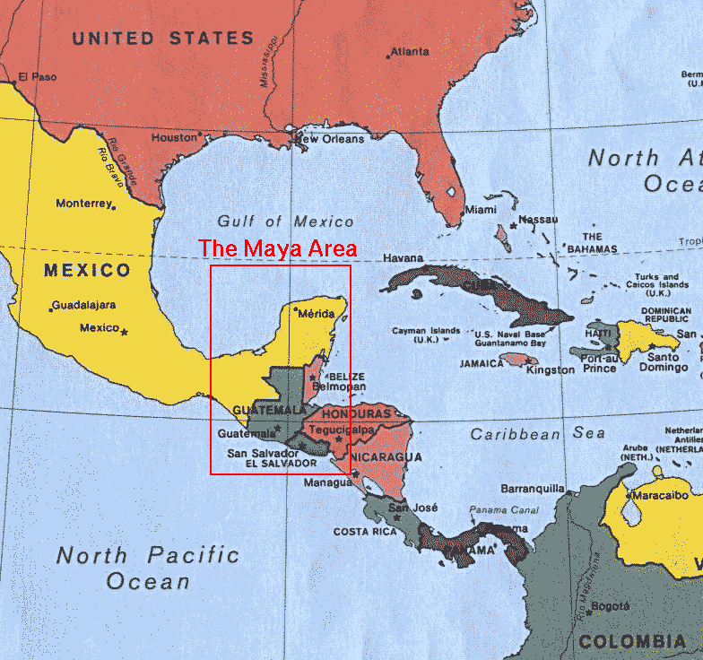 The Maya lived in the area in Central America which now consists of Yucatan, Guatemala, Belize and southern Mexico (the Chiapas and Tabasco provinces). This whole area lies south of the tropic of Cancer, and north of the equator, and is about 900 kilometers from north to south and 550 kilometers in the east-west direction. Theirs was a true Stone Age Culture, although the Maya at the time of Spanish contact in the sixteenth century, did know about working with copper and gold. While the Spanish prized gold highly, the Maya venerated jade.
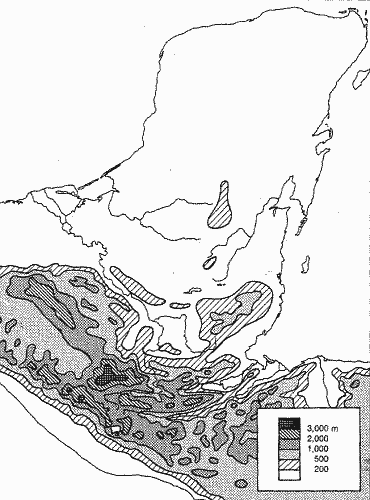 The landscape is very diverse. The Yucatan peninsula is a very flat, relatively young limestone area. The earth's crust pushes it southward into the Guatemalan highlands; as a result high ridges have formed which are covered in rainforest. To the south of the Central American highlands is a belt of active volcanoes, followed by a narrow strip of Pacific lowlands.
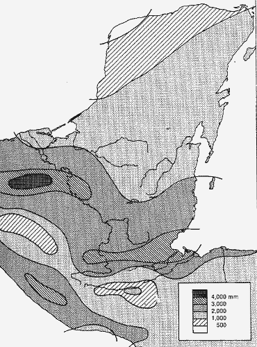 The climate is as varied as the landscape is. In general it is hot and humid, as the area lies in the tropics, and the coast is always near. The rainfall is strongly influenced by the presence of the mountain ranges near the coast, and this creates large differences in rainfall in different parts of the land.
The rainy season lasts from May to December; in the entire Maya area the relative humidity stays above 80% in this season, in the dry season it drops to about 60%. This seasonality governs the agricultural cycle, and it makes it important for the farmers to time their activities accurately.
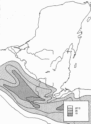 The altitude is the main influence on the temperature; the annual
temperature in the lowlands is between 25 and 30 degrees Celsius, in
the highland plateaus between 15 and 25 degrees, and in the mountains
below 15 degrees.
The altitude is the main influence on the temperature; the annual
temperature in the lowlands is between 25 and 30 degrees Celsius, in
the highland plateaus between 15 and 25 degrees, and in the mountains
below 15 degrees.
These external factors lead to a rough division of the Maya land into three areas: The lowland (the arid Yucatan peninsula), the central rain-forest zone, and the southern highlands and Pacific slope.